Sunday, September 5, 2010
What happened under Canterbury yesterday morning
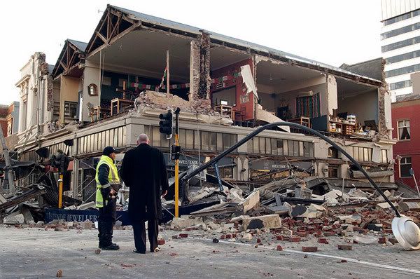
I might not have woken up just after 4:30 yesterday morning if it weren't for our squeaky living room swinging slowly open. It had been pushed from its balance by what seemed to me like a long, but not particularly strong earthquake. Of course, it turned out that it was a particularily strong earthquake, 7.1 on the Richter magnitude moment scale, shallow (just 10km below the earth) and close to Christchurch (putting it 400km away from my bedroom). Like everyone else, I woke up to see pictures of the damage in the city's CBD.
I don't have any particular knowledge of geology, but I wanted to find out just what had happened underneath Canterbury to set the earth shaking. Perhaps readers here will be keen to learn too, so here's what I've found out.
Map modified from wiki-commons version of USGS's original
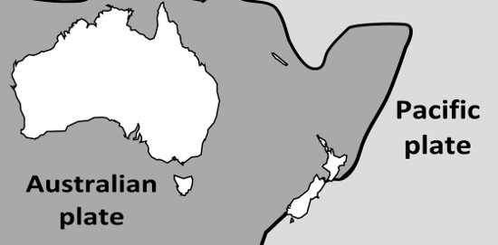
New Zealand's sits right on the boundary of the Pacific and the Australian tectonic plates.This might seem like poor planning, but it's actually the activity at this plate boundary that has kept New Zealand afloat. Some 20 million years ago most of our mini-continent was underwater (in fact, most of our mini-continent is underwater now) and the plate boundary was relatively inert. At about that time the plate switcthed to an active phase, which generated subduction zones either side of the South Island (and resulted in vulcanism of the sort we see today in the North Island's central plateau.) Between the subduction zones the plates collide with each other. It's not a head-on collision, the bulk of the South Island is being moved southward at about 3 cm per year, but the compression that arises from the collision has been enough to send the crust that makes up New Zealand back above the ocean. The most striking result of these collisions is the Southern Alps:

Image from NASA
That line between the snow topped peaks and the coastal plane to the West is the plate boundary.The 450 km long chain of mountains that rise as the Pacific Plate is thrust up against the Australian are synonymous with the rugged beauty of the South Island. But there are risks associated with living a country that is still inventing itself. As you might imagine, mountain building on this scale belies massive forces working under the earth. As the Pacific and the Australian plate slide against each other they carry the crust with them, and that means every now and again something has to give. There hasn't been an earthquake along the alpine fault, which runs along the plate boundary, since Europeans arrived here to record them. It seems displacement between the two plates is more often expressed by quakes in the Marlborough Fault System in the North of the South Island. Yesterday's earthquake was further south than the Marlborough system, along a fault that hadn't previously been mapped. The fact GNS didn't know the fault was there before yesterday doesn't mean it's new, it's only possible to map a fault line from it's surface expression, and it's quite possible for the record of older quakes to be overwritten by fresh geology. Apparently, most of the movement in yeasterday's quake was latteral (rather than up and down), similiar to the eathquakes we would expect from the alpine fault and the Marlborough faults.
We'll learn more about exactly what happened yesterday once GNS scientists have studied their siesmographs and surveyed the area, but we can already summise why the damage varied from suburb to suburb. Part of the reason the CBD was hit hard is that there are more old brick and stone buildings in the central city. Most newer buildings are built to sway in an earthquake, and the vast majority of New Zealand homes are built of wood which can flex and ride out a shake. By contrast, rigid buildings can only move so much before they give way.
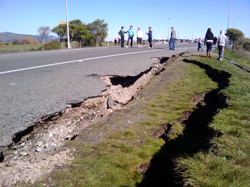
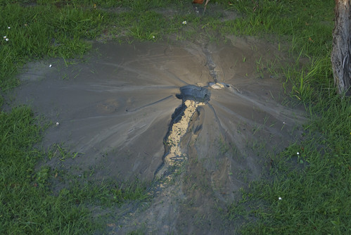
The surface on which buildings sit also has a lot to do with how they are effected by earthquakes. This photo from Richard Walker's flickr stream illustrates the cause and the result of a process called liquefaction:
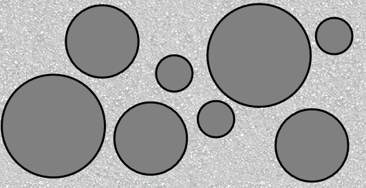
While tectonic plates have been making mountains in the South Island, the elements have been breaking them down. Rivers and glaciers have been scoring away at the alps, bringing rocks down from the mountains to the Canterbury plains in the process. Much of Canterbury sits on layers of gravel and stone delivered to by the braided rivers that characterise the region. Most of the time these gravel beds provide a solid footing, because friction between the stones holds them in place. Something like this
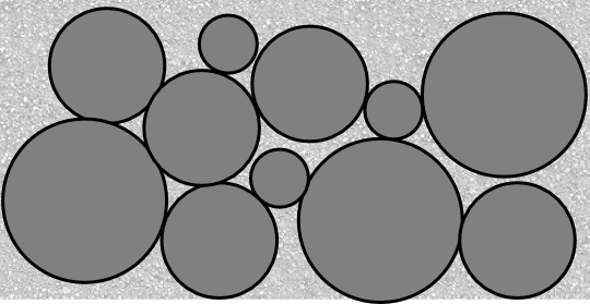
What happens when you shake a structure like that up? The large stones can effectively become suspended in the silt or sand that usually fills up the gaps. In the worst cases (well sorted stones suspended in wet silt) the whole thing can start to behave as a fluid and cause major changes at the surface:
As you can see, i couldn't fit as many stones in my "suspended" version of the gravel bed. All those stones and gravel have to go somewhere and under certain conditions the increase in pressure caused by liquifaction under the surface can form "sand volcanoes" that erupt through the topsoil. Jon Sullivan recored just that phenomenom in a Hoon Hay backyard.
There's plenty more coverage of the earthquake on the net. Geoblogger Chris Rowan has a post with a more thorough run down of the geological setting of the quake and sciblogs has Grant's constantly updated post and some neat maps from Chris McDowall.
Labels: Christchurch, earthquake, geology, sci-blogs, science
0 Comments:

All content not otherwise marked is licensed under a Creative Commons Attribution-ShareAlike 3.0 Unported License.